Research impact: Tracking storms through crowd-sourced data
A collaboration between the UK Met Office and the University of Leeds has used crowd-sourced weather data to better track extreme weather as it moves across the country and provide more accurate weather warnings.
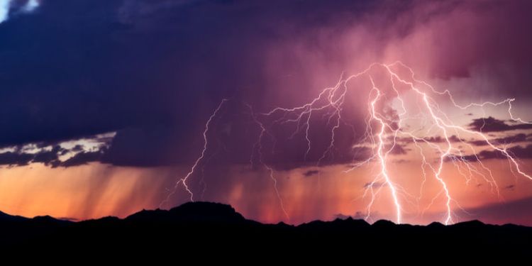
Extreme weather – such as flooding, storms and tornadoes – is often linked to warm and cold fronts, and these tend to retain their shape as they move across the UK. If you can track a weather front in real time, then it’s possible to predict when the front – and extreme weather associated with it – will reach certain parts of the country.
To make this kind of prediction, Met Office Scientist, Matthew Clark, working with Professor of Meteorology at Leeds, Doug Parker, developed a system to automatically analyse the data from the Met Office’s more than 200 weather stations. These stations take readings every minute, gathering information on temperature, wind, pressure and rainfall.
But with weather stations often 30km apart, this only provided limited data points. To make the system more accurate, Clark turned to the Met Office’s national weather observation website, or WOW. WOW allows amateur meteorologists with their own weather stations to pass data automatically to the Met Office, adding many hundreds more data collection points to the network. This crowd-sourced data allowed Clark to create a map at a high enough resolution to accurately track the progress of a storm.
Professor Parker explains: “When a storm hits, it used to be very difficult to see what was happening on the ground in real time. It is terribly frustrating for a forecaster to know that severe weather is happening, but not to be able to pinpoint accurately which locations are about to be affected. With this new tool, forecasters now have an accurate picture of what’s happening hour by hour and minute by minute, which provides a real step forward in their ability to send alerts in good time.”
The new data also enable forecasters to use their expertise in the formation of storms, to predict where new storms may pop up. “Predicting where new thunderstorms appear is one of the hardest challenges to a forecaster, because storms are caused by the lifting of patches of warm and humid air, on spatial scales of only a few kilometres,” says Professor Parker. “The new data products enable forecasters to see these patches of storm-producing air in near-real-time.”
The new data products enable forecasters to see these patches of storm-producing air in near-real-time.
To spend more time developing this work, Clark has been studying for a part-time PhD at Leeds. He has gone back into the archives, making use of UK tornado observations by members of the public over a 35-year period. Around 30 tornadoes occur in the UK each year, 40 per cent of which develop on cold fronts – but a lack of forecasting methods for these conditions means they strike without warning.
Working with Professor Parker, Clark looked at similarities in the weather conditions associated with the tornados, establishing which cold fronts were likely to produce a single tornado, which could produce several, and which would produce none.
Using these findings, they created a predictive tool, which is already in use on an experimental basis by the Met Office to pinpoint regions at increased risk of tornadoes.
Contact us
If you would like to discuss this area of research in more detail, please contact Professor Douglas Parker.